
Montgomery County ZIP Directory Coverage
This Montgomery County postal directory uses a county-intersecting ZIP and ZCTA verification list. A ZCTA is a Census statistical approximation of ZIP territory, not a delivery decision for one address. The list was produced from the official Pennsylvania ZIP/ZCTA layer and the Montgomery County boundary, then grouped by local geography. Each listed ZIP may cross a municipal or county line. Use USPS to confirm an exact address and postal city before relying on a row.
| ZIP or ZCTA | Montgomery County area to validate | Postal association to verify | County geography note |
|---|---|---|---|
| 18041, 18054, 18070, 18073, 18074, 18076, 18092 | Upper-county edge | East Greenville, Green Lane, Palm, Pennsburg, Perkiomenville, Red Hill, Zionsville | Lehigh and upper-Montgomery overlap; verify each address |
| 18914, 18915, 18932, 18936, 18964, 18966, 18969, 18974, 18976 | Central and northeast edge | Chalfont, Colmar, Line Lexington, Montgomeryville, Pottstown-area, North Penn | Several delivery areas extend toward Bucks, Lehigh, or Chester |
| 19001, 19002, 19003, 19004, 19006, 19009, 19010, 19012 | Southern and eastern county | Abington, Ambler, Ardmore, Bala Cynwyd, Blue Bell, Bryn Mawr, Cheltenham, Elkins Park | Main Line and Philadelphia-adjacent postal names do not equal municipalities |
| 19025, 19027, 19031, 19034, 19035, 19038, 19040, 19041, 19044, 19046 | Eastern county | Dresher, Elkins Park, Glenside, Hatboro, Jenkintown, Lafayette Hill, Oreland, Willow Grove | Some ZIP areas cross county or municipal lines |
| 19066, 19072, 19075, 19083, 19085, 19087, 19090, 19095, 19096 | Main Line and inner suburbs | Merion Station, Narberth, Oreland, Havertown, Wayne, Wynnewood, Willow Grove, West Conshohocken vicinity | Confirm jurisdiction in the county municipal map |
| 19111, 19115, 19116, 19118, 19119, 19120, 19126, 19127, 19128, 19131, 19138, 19150, 19151 | Philadelphia postal edge | Philadelphia ZCTAs touching or serving county-edge areas | Use special care when selecting a city or county custodian |
| 19355 | Western county edge | Malvern postal area | Chester and Montgomery cross-boundary area |
| 19401, 19403, 19405, 19406, 19422, 19426, 19428, 19435, 19436, 19437, 19438 | Norristown, King of Prussia, and central county | Norristown, Eagleville, Bridgeport, King of Prussia, Blue Bell, Collegeville, Conshohocken, Frederick, Gwynedd, Harleysville | Core postal areas still require address and municipality checks |
| 19440, 19444, 19446, 19453, 19454, 19456, 19460, 19462, 19464, 19465 | Upper-central and Pottstown edge | Hatfield, Lafayette Hill, Lansdale, North Wales, Oaks, Pennsburg, Phoenixville, Plymouth Meeting, Pottstown | Postal place may differ from the parcel's township or borough |
| 19468, 19472, 19473, 19474, 19475, 19477, 19490, 19492 | Perkiomen, Royersford, Souderton, Skippack, Telford area | Perkiomen and upper-county postal associations | Some are special, PO, or cross-county delivery areas; USPS confirmation is needed |
| 19504, 19505, 19512, 19518, 19525 | Northwestern county edge | Barto, Bechtelsville, Boyertown, Douglassville, Gilbertsville | Berks, Lehigh, and Montgomery overlap |
The research did not verify a USPS post-office designation or delivery-only status for every individual ZIP. The table therefore identifies postal associations and geographic cautions rather than labeling each row as a post office, PO-box ZIP, or unique ZIP. A live USPS address result is the source for that final determination.
Note: A live USPS result is required before calling any listed postal area a delivery-only, post-office-box, or unique ZIP.
Montgomery County ZIP Postal Edges
Montgomery County is unusually dense with shared postal geography. The upper edge includes 180 and 195 territory that intersects Lehigh or Berks areas. The eastern edge includes 190 and 191 territory associated with Main Line and Philadelphia postal names. The western 19355 area reaches toward Chester County. None of those Montgomery County postal patterns determines which municipality holds a local permit, code, or planning record.
There are 62 municipalities in Montgomery County. A Norristown, Pottstown, Lansdale, Main Line, or Philadelphia-style postal label can differ from the township or borough shown by the county parcel system. The county municipal-boundary map is the proper next check when the question is local government custody. USPS answers the mailing question. The parcel and municipal layers answer the local records question.
Checking Montgomery County ZIP Records
The official USPS ZIP Lookup is the starting point for a Montgomery County postal check. It offers By Address, By City and State, and Cities by ZIP modes. Address lookup accepts a street address, with an optional company field and apartment, suite, or other detail. City and State selects Pennsylvania from a dropdown and can return ZIP associations; Cities by ZIP works from a five-digit ZIP.
| USPS field or mode | Type | Required | Published use |
|---|---|---|---|
| Company | Text | Optional | Used in address lookup; it does not confirm a person or company at the address. |
| Street Address | Text | Yes for address lookup | Enter the street address; unit detail can improve a match. |
| Apt/Suite/Other | Text | Optional | Additional unit or location detail. |
| City | Text | Yes for city/state lookup | Postal city field. |
| State | Dropdown | Yes for city/state lookup | Select Pennsylvania. |
| ZIP | Text | As required by selected mode | Five-digit postal code for the relevant address or city-by-ZIP search. |
| Find | Button | Not applicable | Runs the selected lookup. |
| By Address / By City and State / Cities by ZIP | Tabs or modes | Choose one | Address-to-ZIP, city/state-to-ZIPs, and ZIP-to-city associations. |
Myth: a USPS match proves that a person or company is at the address. USPS says its result does not make that confirmation and cannot guarantee that a displayed business address is the actual location. A Montgomery County postal result validates routing, not occupancy or government jurisdiction.
Montgomery County ZIP Searches
No documented county assessor, Recorder, GIS, or voter web search produces countywide results filtered by ZIP. The practical Montgomery County ZIP workflow is therefore address-first. Use the postal result to standardize an address, then shift to the county Property Records application with the street address or parcel ID. The Montgomery County interactive tax map and municipal-boundary layer supply the location context that a ZIP cannot.
- Use the USPS address mode to validate the full street address, unit detail when relevant, postal city, state, and ZIP.
- Open the county Property Records application and search by the validated street address or the parcel ID when it is known.
- Check the parcel and the county municipal-boundary map to identify the borough or township that controls local records.
- Use the Recorder's address or parcel-ID criteria for recorded documents when the question concerns a deed or related land record.
- Move to the municipality's clerk or records channel only after the address and jurisdiction are established.
Once the ZIP has narrowed the mailing area to one address, the Montgomery County By Street directory provides the address and parcel sequence. Do not turn the ZIP into a substitute for that more precise Montgomery County record trail.
Note: No official Montgomery County portal documented a ZIP filter that returns all county assessment, Recorder, GIS, or voter results.
Montgomery County Property Record Fields
The Board of Assessment property-records information confirms the important handoff from postal validation to parcel research. The public Property Records application offers Search by Address, Search by Parcel, Advanced Search, Map Search, and Sales Search. It does not offer owner-name searching; the county removed that option on June 17, 2022 for privacy reasons. That makes a verified address or parcel ID the useful bridge from a ZIP result to county property data.
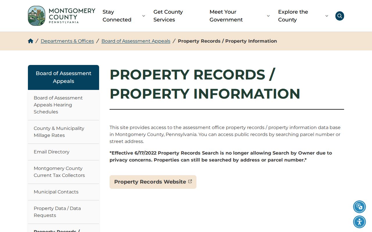
The image shows the Montgomery County property-records information source used after the postal check. The Board of Assessment maintains property and building data and tax maps for more than 300,000 parcels. Its free application is a parcel and address resource, not a Montgomery County ZIP directory or a name-based resident list. The county also offers no-charge data downloads and custom data or map requests, with a quote provided before custom work.
Montgomery County ZIP Filter Myth
Myth: the assessment, Recorder, GIS, or voter systems can list everyone in one ZIP. The documented Montgomery County portals do not support that claim. Property Records publishes address and parcel-ID paths. The Recorder's Public Access System publishes name, address, and parcel-ID criteria after account login, but not a ZIP mode. The tax map provides parcel relationships and map context, not a ZIP-wide resident roster. The voter-status tool is an individual self-service route, not a public browsing tool.
For a recorded document, the Recorder has several access channels after the address or parcel is identified: a free account for public search, paid remote images, public counter computers, and mail or counter copy procedures. Those choices answer a document-access question. They do not create a ZIP-wide list. The same distinction keeps the Montgomery County postal directory faithful to the published search fields.
Montgomery County ZIP Boundaries
A ZIP boundary is a postal-routing construct. A municipal boundary identifies the borough or township government. A parcel boundary identifies land in the county's assessment and tax-map systems. These three Montgomery County geographies often overlap, but they do not replace one another. When a result appears inconsistent, compare the street number, municipality, parcel ID, and legal description before assuming an error.
| Geographic label | What it answers | Montgomery County source |
|---|---|---|
| USPS ZIP | How mail is routed and the associated postal city | USPS address, city/state, or ZIP-to-city lookup |
| Municipal boundary | Which borough or township is the local government | County municipal-boundary map and GIS data |
| Parcel identity | Which physical lot is being researched | Property Records, tax map, TAXPIN, and deed materials |
Philadelphia-edge ZIP areas and Main Line postal names make this comparison especially valuable. The correct records custodian follows the municipality and record type, not the ZIP alone. A postal city can be useful on mail and still be the wrong label for a parcel or municipal request.
Note: Montgomery County municipal boundaries, not postal areas, determine the local government to contact for a permit or code record.
Montgomery County ZIP Address Terms
County records use several address terms that should not be collapsed into a ZIP label. A situs address is the physical parcel location used by Property Records. A mailing address is where correspondence or billing goes and may differ from the situs. A legal description is the lot, block, subdivision, plan, or other land description carried in a deed. A parcel ID is the county land identifier that links an address to tax-map and property data.
- ZIP
- A postal routing code, not a municipal or parcel boundary.
- ZIP+4
- An added delivery detail used with a five-digit ZIP; USPS returns it for qualifying address results.
- PO-box ZIP
- A ZIP used for post-office box delivery; verify this classification in the live USPS result for the address or ZIP.
- Unique ZIP
- A ZIP assigned for a particular organization or delivery purpose; do not label one as unique without USPS verification.
- Carrier route
- A postal delivery grouping that is different from a county parcel, municipality, or resident roster.
Montgomery County ZIP Directory Reality
The value of a Montgomery County ZIP code directory is geographic triage. It can confirm the mailing form, reveal a cross-boundary caution, and guide the next address search. It cannot establish a current resident, confirm a business location, prove a municipal jurisdiction, or replace a parcel record. That is why the sequence matters: USPS for the delivery address, county property and GIS sources for the parcel and municipality, then the office that actually holds the sought record.
For a personal history question, preserve all four layers in notes: postal city, ZIP, municipality, and parcel ID. Montgomery County's dense mix of upper-county, core 194, Main Line, Philadelphia-edge, and western postal areas makes that habit more dependable than relying on any one label. It also provides a clear way to explain a mismatch to the correct Montgomery County or municipal custodian.